Thursday, 26 December 2013

Ingalalla Waterfall - Second Valley Forest Reserve, South Australia


While I expect that most of my posts here will be about awesome places to be seen in The Territory, since I'm back home for Christmas I thought I'd mention a local spot - Ingalalla Waterfall, or Puttland's Waterfall in the old money.  Somehow despite the falls being 'just down the road' from where I spent the first 18ish years of my life I hadn't heard of the place till last night when it came up in conversation over Christmas dinner.  So as I had nothing planned for today I decided to go check them out with mum. 
Picnic area near the base of the falls
 
The walk to Ingalalla Falls

Turns out Ingalalla Falls (GPS coordinates 54H TF 59089 64799) are quite well sign posted.  Heading down Main South Road from Yankalilla to Normanville you turn left (at the sign) onto Hay Flat Road.  About 10 kilometres down Hay Flat Road you will see another sign for Ingalalla Waterfall directing you to the right and into Second Valley Forest Reserve.  A very short distance down the road is a shady car park with a couple picnic tables.  About 500 meters from there, passing over a little foot bridge is the base of the falls where there is a second shady and well maintained picnic area.  The hillside along the path is currently in full bloom with St John's Wort, giving it a pretty yellow glow.  I'm not actually very good with plant names but mum was there to point it out.  They say it's good for depression but I ate a bit of it and reckon eating much of that would soon get pretty depressing.


After spending the last 3 years exploring around the NT it's pretty safe to say that Ingalalla is not the most spectacular set of falls I've encountered and although the risk of getting eaten by a croc there is pretty minimal I still wouldn't be too keen on jumping in for a swim right now.  The water at the bottom wasn't looking all that inviting this time of year.  That said it's not a bad spot for a quiet picnic and would of course look a little different in the wet season (winter for the Southerners).  
Ingalalla Waterfall and plunge pool - if you look closely you can see Mum sitting near the big rock to the right


Looking down from the side of the hill
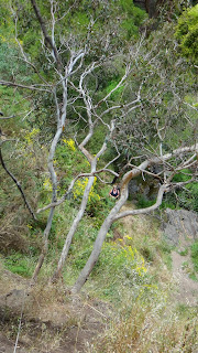
If you walk around to the left side of the falls it's possible to scramble up to the base of the upper section of the falls.  There is another smaller plunge pool there but it is currently a simular shade of frothy brown to the one at the base.  To the right of the falls there is a narrow 'path' that has been worn into the steep hill.  I ventured up but it's not the easiest climb.  The ground was dark loose bull dust - prime for falling on your bum and either side of the path is thick with black berry bushes.  Excellent for spiking yourself on.  Part way up the side of the hill some nice chap or chapet has tied a rope to a couple trees which you can use to pull yourself up.  It came in very handy.

Beyond the rope I scrambled a bit of a way further up.  The plan was to then cut across to the left and get to the very top of the falls.  Once I got there it soon became pretty evident that that was not a realistic goal without gaiters and riggers gloves (and maybe a welding mask, machete and a knapsack of Roundup).  The shrubbery up there was solid black berries and something else even more spikey.  So I abandoned that idea and part scrambled part slid on my bottom back to the base, fortunately with only minor injuries.

Mum tells me that when she came there as a kid there used to be a set of stone steps that went up the falls along the right side of the falls.  If you know what you're looking and squint your eyes and tilt your head just right you can make out a few of the steps.  But quickly these disappear into the black berries and what's left of them is hidden away.

Despite it being not the most grand of waterfalls Ingalalla is very accessible and makes for a pretty nice backdrop for a quite afternoon picnic even now in the Southern summer. 


Visited 26.12.2013

Tuesday, 10 December 2013

Stapelton Falls - Litchfield National Park, Northern Territory


Upper Stapelton Falls

Stapelton Falls is an apparently little known waterfall In Litchfield National Park NT.  There are no roads to it, no signs, no paths.  One of those places I stumbled upon looking over old topographic maps like the nerd I am at heart.  It may not be as wide as Florence or as tall as Wangi but it's a pretty nice spot for a quiet swim when the rest of the park is ridiculously crowded.  Which is often the case and takes away some of the magic of the place.

Looking back up towards lower Stapelton Falls
I've visited Stapelton twice now.  The easiest and most accessible access I've found is leaving by foot from the Tolmer Falls car park.  The car park is located 39.8kms from the Litchfield NP sign when you take the Bachelor entrance in.  Conveniently there are toilets and an emergency call device (ECD) located there.  Coming via this route the road is sealed all the way.  From here the falls are only about a kilometer away 'as the crow flies'.

Tolmer Arch
Last year my mate Alex and I took the awkward way there.  We climbed down a stupidly steep drop then pushed our way along the creek flowing from Tolmer Falls then over the side of a hill and up to the falls from the bottom end of Stepelton Creek.  The trip back was much easier since we went over the top of the escarpment and did a sneaky crossing over the Tolmer rock arch (shhh!).

Learning from my mistakes, this year when I went back with my girlfriend Jess we took the easy route there and a similar path back.  The walk over the top of the escarpment is relatively flat but I'd highly recommend the wearing of gaiters or at least long pants because the spinifex is pretty dense.  And bring your bushmans!  There were hungry flies an inch long that loved to bite.  Also watch your step closely, we happened upon a random drop to a cave a very long way down.  Falling into something like that would not end well. 

When it comes to navigating I have a personal preference for the MGRS coordinate nomenclature.  Mostly because you can read it directly off of the Royal Australian Survey Corps maps I use.  You will find the top of Stapelton Falls on the 1:50,000 Mount Tolmer map at 52L FL 85864 38689.  Jess and I had a little discussion about how we would describe Stapelton:

'The Shower'
"There is a series of cascading rockholes culminating in a 10 meter drop.  The water cascades vertically down the rock face, dodging the trees growing determinately from the stone.  From the plunge pool at the base the water sweeps around to the right via a narrow creek.  Here it takes a short plunge into a walled spa.  It then flows under a stone archway and over a 6 meter descent into a large 'shower alcove'.  A final short drop into a wide but mostly shallow pool marks the base of the falls.  The water then trickles down a small creek to join the runoff from Tolmer Falls".

Water flowing into the 'spa' and under the stone archway


Jess and I both agreed we'd rate Stapelton as well worth a second (third) trip.

Now that the wet season is slowly beginning it's a pretty nice time to hang out at the falls.  The water is flowing strongly so stagnate water in the larger pools isn't an issue like it was when I went the first time.  The flow into 'the shower' at the moment is so strong that standing underneath feels like a rough Thai massage.  Though on the other hand it's damn hot trekking around in the buildup/wet season.  We left Darwin pretty early in the day to avoid the heat on the walk out but by the return trip the sun was out with a vengeance.  So if you're going this time of year make sure you bring lots of water and drink it even though it's not a long trip.  Parks wouldn't be very happy about stretchering you out.  If they do, don't tell them I sent you!


Visited 02.12.2013

Welcome to Foty's Misadventures


Me: Katherine Gorge, Lilly Ponds entrance
(Photo by Fiona Reardon 2012)
Three years ago in November I decided it was time for me to escape the dreary Adelaide winters and I moved north to Darwin for work.  I didn't know how long I would stay 'up North' and I didn't want to go back without seeing some of the amazing places everyone was telling me about.  Still it wasn't until the following Easter that I made my first trip 'out bush'.  My housemate and I drove my little green Festiva down to Litchfield National Park.  We visited Tolmer Falls first, doing the loop walk there then went to Florence Falls for a swim and did the walk from Florence to Buley Rockholes, stopping to swim in the natural spas along the way.  (Though back then the path was just dirt, not the fancy cement path that's there now.)  I was blown away by the beauty of the park.

From that day I was hooked.  I started to wonder what else was out there.  Since that day I've 'gone bush' as often as I can and I'm always searching for new places to explore and new adventures, trawling over topographic maps looking for my next great find.  I've shared pictures from most of my trips with friends and family through my Facebook page (lisa.murphy.334@facebook.com if you want to see any of my previous adventures).  I thought though it might be nice to start adding some words to the pictures so that others can learn from my adventures and misadventures, and in the hope that it encourages like minded travelers to share their special spots!